Lurg Mhor and Bidein a'Choire Sheasgaich 1st May 2011
With only 12 more Munros to climb, a plan had been laid to head up north at the very end of May. Easter holidays were taken up with a trip to Madrid (where we managed a day in the Sierra de Guadarrama), and all the other weekends in May had other engagements already pencilled in.
However, a large stable high pressure system settled itself over northern UK at the end of April, and I was unable to resist the opportunity for an earlier-than-expected trip north. And so, having celebrated Dad's 88th birthday, I set off from Newcastleton up the M74 at 3.30pm on Saturday 30th April.
What a beautiful evening, with fantastic views of the hills as I took the scenic route up through Callander, over Rannoch Moor and down through Glencoe. After refuelling at Fort William (diesel for the car, smoked sausage supper for me!), and with the light beginning to fade, I continued up by Loch Lochy and Loch Garry.
 |
| the "map of Scotland" viewpoint above Loch Garry |
Leaving all the traffic behind, I eventually rolled into the walkers' car park at Attadale Gardens at 10pm, and settled down for a sleep in the Espace.
Next morning, the dawn chorus woke me before 6am, but I snoozed until 7. This was going to be a big day - cycling, walking and climbing - and as the first Munro outing of the year, I wasn't sure how the old legs would respond!
 |
| Attadale car park - 7am |
The Attadale estate is to be congratulated on its helpful information display, walkers' car park, well-maintained bothy at Bendronaig, and generally welcoming attitude to responsible walkers.
At 7.50am, I was off. The first mile or so was up a well-tarred road, more or less on the level, then the hard work began! In the next 4km, the track climbed from sea-level to a bealach at 350m.
 |
| just starting the climb up the track |
I pushed the bike up the steeper sections (saving the legs for later exertions!) but was able to cycle some of the way.
 |
| nearly at the top! |
Although steep in places, the surface of the track was fine for cycling, even on my road bike. The most dramatic section was the final climb up alongside a gorge to Loch na Caillich, then up the hairpins beyond.
Eventually, the track levelled out, and the two Munros appeared, still 4 miles away:
 |
| Bidein a' Choire Sheasgaich (left) and Lurg Mhor (right) from the high point of the track |
Now gravity took over, and I was able to trundle downhill towards my destination. The thought of having to cycle back up here later in the day was pushed to the back of my mind. Just before reaching Bendronaig Lodge, the track makes a detour to cross the Black Water by a fine 100-year old bridge.
 |
| the bridge across the Uisge Dubh |
Just under 2 hours after leaving the car park, I arrived at the bothy, 11km in from the road. Ahead the track deteriorated, so it was time to abandon the bike and start walking.
I chatted to an older couple who had been camping, and had climbed the two Munros the day before, then set off up the track, now 10am.
If I thought the hard work was over, I was wrong! After following the track for 3km up Coire na Sorna, Lurg Mhor's bulky slopes lay before me. The next 2 hours was a wearying toil up pathless grassy slopes, slanting across the hillside above Loch Calavie towards the bealach between Lurg Mhor and Bidein a'Choire Sheasgaich. Rather than climbing right up to the bealach, I clambered up a steeper slope on the right to reach a small plateau at about 830m. The summit cone of Lurg Mhor lay ahead!
 |
| approaching Lurg Mhor's summit cone |
A final push up the steepening ridge, and at 12.55 I was on the summit - a wee flat grassy area with a large cairn in the middle. Suddenly, a different view opened up. Instead of the broad grassy flank I had ascended, a steep rocky coire dropped away beyond the cairn, and an exciting ridge lay ahead, linking the summit to Meall Mor, its subsidiary top.
 |
| the summit cairn of Lurg Mhor with Meall Mor behind |
 |
| the ridge to Meall Mor |
 |
descending the ridge from Lurg Mhor's summit
|
I decided to continue to the outlying top before stopping for lunch.
The next 30 minutes proved to be the most entertaining part of the day!
Initial progress along the jagged crest descending from Lurg Mhor was straightforward enough, with steep grassy slopes to the right, and jagged rocky drops on the left. I made good progress until a sloping slab gave pause for thought! A short retreat was required, but the slab was easily passed by descending 10m or so on steep grass to its right.
Soon I reached the lowest point between the two tops.
The ascent towards Meall Mor started easily enough. A short rock band astride the ridge was fairly easily climbed near its left hand end.
 |
| looking back at Lurg Mhor - the tricky slab level with the top of the snow patch |
Beyond this another rock band, perhaps 5m, high appeared to block the way. It could probably have been climbed, but, being on my own at a fairly remote location, I decided that it would be wiser to find a way around. This involved descending about 40m on steep grassy slopes on the right - fine today, but it would no fun on a wet day - to find a point where the rock band could be crossed, then a steep grassy ascent back to the ridge.
Once past this obstacle, it was a gentle stroll to Meall Mor's smooth grassy summit. Time now 13.25, so I found a pleasant spot to sit and eat lunch, while admiring the views - especially to the north.
 |
| Lurg Mhor from Meall Mor |
 |
| Bidein a' Choire Sheasgaich from Meall Mor |
And some more distant views ...
 |
| An Ruadh Stac, Beinn Damh and Maol Chinn-dearg from Meall Mor |
 |
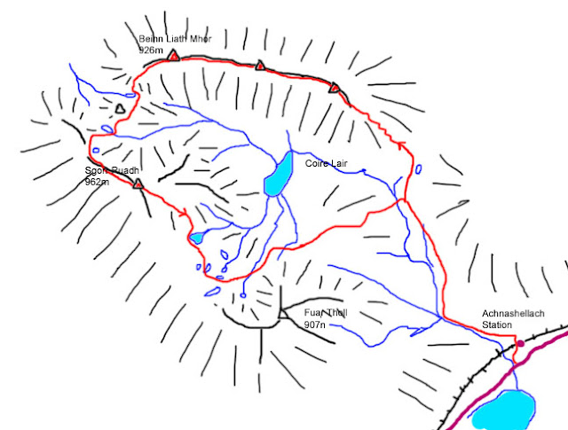
| distant view to Fuar Tholl, Sgorr Ruadh, Ben Alligin, Mullach an Rathain and Beinn Liath Mhor |
Pleasant as it was to sit in the sun, it was now nearly 2pm, and I was a long way from my base camp, so time to head back along the ridge to Lurg Mhor. I retraced my steps almost exactly, and was soon back on the Munro.
 |
| approaching the last rock step on the way back to Lurg Mhor - easily climbed on the crest at the right - and conditions just right for some impressive con-trails in the sky |
 |
an omen of the election to come - vapour trails above
Bidein a'Choire Sheasgaich predict an SNP victory? |
From Lurg Mhor, I retraced my steps down to the plateau area at 830m, then down another short steep section to the bealach at 730m.
From here, a path led the way up the steep grassy slopes of Bidein a'Choire Sheasgaich.
A word here about names, as today's two Munros are not only two of the most inaccessible, but also two of the most unpronounceable (to non-Gaelic speakers, anyway).
Lurg Mhor is "the big shank", and pronounced "loorrook voar".
Bidein is "the pinnacle of the coire of the farrow (not pregnant) cattle", with Sheasgaich pronounced "heskeech" - not "cheesecake" as some call it!
Language lesson over!
Just below the summit, I met (again) two walkers - father and son, I think - and stopped for a chat (they wanted to know what the wee ridge had been like). 50 minutes after leaving Lurg Mhor, I was atop Bidein, with only 10 more Munros to climb!
 |
| only 10 to go! |
Another walker had just arrived (having come up from Craig), so we sat and chatted about mountain experiences for the best part of half-an-hour.
At 3.45pm, I left the top, walked along the short nearly level summit ridge, then descended SW towards Sail Riabhach ("brindled heel"), along an interestingly lumpy shoulder.
 |
| looking back at Bidein A'Choire Sheasgaich's summit |
 |
| View from Sail Riabhach, with Skye out to the hazy west |
From Sail Riabhach, continuing in a SW direction, I made a rapid descent down steep grassy slopes (how many times have I said that today?) back to the track through Coire na Sorna ("coire of the furnace"). By now it was certainly hot enough to live up to its name, and the pool at its foot looked very inviting.
 |
| inviting pool, with Lurg Mhor just peeping over in the distance |
However, I decided that time was pressing, and I reached my bike at Bendronaig Lodge just after 5pm. 10 minutes rest, then off along the track.
 |
| looking back to Bendronaig Lodge with Bidein a' Choire Sheasgaich (left) and Lurg Mhor (right) |
In fact, the climb back up to the bealach wasn't too bad, and I only had to get off and push on a couple of short steeper sections.
The descent looked trickier, especially the initial hairpins! I did get off and walk down the first 2 or 3 bends, but then was able to cycle most of the rest.
 |
| steep descent! |
With brakes full on, I rattled my way down the track, clinging on to the handlebars for dear life, and then sped along the final tarred section back to the car. I hour 25 minutes from Bendronaig Lodge. I think I may need to buy new brake blocks!
So, the questions now are:
(1) what's the weather forecast for tomorrow? and...
(2) if it's good, am I fit for another big walk without a rest day?
A quick phone call home ascertained that the answer to question (1) is "another excellent day", so the answer to (2) has to be "yes, let's go for it!" Read on ...
Summary:
2 Munros + 1 Top
14km walk + 22km cycle
1550m climb
11 hours
left car | 07:50 |
|
Bendronaig Lodge | 09:45 - 10:00 |
|
Lurg Mhor (M) | 12:55 |
|
Meall Mor (T) | 13:25 - 13:55 |
|
Lurg Mhor (M) | 14:20 | |
Bidein a'C S | 15:10 - 15:45 |
|
Bendronaig Lodge | 17:10 - 17:20 |
back to car | 18:45 |
posted 01/05/11
 At 9am, I began the ascent up a steep path, in short zigzags between rocks, grass and scree. Hard going, but gaining height very rapidly. The views across to Fuar Tholl encouraged frequent stops!
 What a joy to take off the boots, and plunge my hot tired feet into the cold water!


